Just beyond the western borders of Drayton Valley is a series of township roads and secondary highways that creates an amazing training ground for anyone looking to tackle the DV100, DV60 or the DV40, this September.
The best part about these routes is that in all cases two thirds of the route are on quiet highways and secondary roads, they are all paved and you can choose the level of difficulty and distance you want to tackle that will best suit your training needs. They also all circle back to Drayton Valley, and/or you can combine several circles to increase ride distance without having to navigate exceptionally far from home.
Assuming you already know the basics of training for a cycling event, that your equipment is in working order, and that you have some knowledge on how to ride and share the road with vehicles, we are going to dive right into the routes.
Heading west out of town on 50th Ave, you will find yourself on Twp 492. This road forms what I would call the trunk from which all other routes take off from.

Training route 1: Twp 492 – RR80 – Lodgepole highway
Approximate distance: 20-25 km
After you crest the hill at Poplar Ridge on Twp 492 you will pick up speed heading downhill out of town, mid-way down the descent you will come across RR80 heading south.
This route begins with a descent, then follows a steady climb to the community of Violet Grove. Looking east you will see a beautiful view of Drayton Valley on the hill in the distance. To the west you will bike past some quiet farmlands, and acreages. The ascent to Violet Grove is gradual and is a great place to start if you are progressing from a hobbyist road cyclist to a weekend warrior.
Past Violet Grove you descend to the junction of AB-620 (Lodgepole Highway). Turning east back to Drayton Valley you will have another gradual climb. This highway does have industrial traffic but there are very wide shoulders, so do not be intimidated, just make sure you are visible and stay on the shoulder. After you crest the hill on the bend of the AB-620 you will have a speed descent nearly all the way back to Drayton Valley, with a ride out of a coulee just before the junction of AB-620 and Hwy 22.
If you continue east and enter Drayton Valley on the south entrance, the shoulder does get really narrow here. However, traffic is slower. Keep calm and stay in your lane.
My buddy and I did this ride this weekend and biking at a very relaxed pace it took about an 1 hr and 34 minutes to complete the 24km route.
Training route 2: TWP 492 – RR81 – Cynthia highway
Approximate distance: 25 km
If you take the downhill from Poplar Ridge all the way to the base then you will find yourself near RR81.
RR81 heading north is a very relaxed segment of this ride. With an exceptionally long and gradual uphill and long and gradual downhill there is minimum elevation gain so it is a great place to practice some tempo training. Heading east on the Cynthia highway, the shoulders are a nice width, and I have found the traffic is very good at giving cyclists space if possible.
You will find the downhill on RR81 is followed by more downhill on the Cynthia highway, that is until you come to a rather short but steep hill that will give you some great strength building riding resistance. Trudge through this and it is downhill all the way to Rocky Rapids.
Riding through Rocky Rapids, turn south on RR 73 to make your way back to town. This part of the ride is mostly uphill with a bit of reprieve from the airport road (Twp 494) to the bottom of the coulee.
This is a great ride to build strength and work on cadence, as long as you don’t catch industrial rush hour in the morning or around that 5 pm time frame the roads are pretty quiet.
Last year I took part in this ride with my kids on my way to my aunt’s house on RR84. They were in the bike carrier, we were loaded down with our camping gear, and clothes and with my weight and their weight we were hitting the max weight capacity of 200 lbs. It was slow going but doable and much more enjoyable than the ride back via RR85.

Training route 3: TWP 492 – RR 82 – Lodgepole highway
Approximate distance: 30.2 km
The newly paved RR82 has now opened up another training route that you can choose. At 30.2 km it is only 5 km to 10 km longer than our other routes and so a great stepping stone to longer distances.
Accessing RR82 is a steady climb, that will get your quads burning and your lungs huffing, but on the bright side you won’t have to do the complete hill climb you will be checking out just before the first false crest.
Once on RR82 there is a very gradual climb to Cottonwood Acres then it’s downhill to the Lodgepole highway. This is one ride where you can choose to combine with RR80 to limit your time on a busier highway, this change does not make your route any longer but it does add some variety to your training.
Once on the Lodgepole highway you head back to Drayton Valley the same way noted in the RR80 route. The ride between RR82 and RR80 on the Lodgepole highway is a pretty steady downhill, with decent shoulders.
Head into town on the southside entrance.
Training route 4 and 5: TWP 492 – RR 85 north or south
Approximate distance: 38 km – 40 km
Congratulations! You have crested the big long hill on Twp 492 and on a clear day you will see the awe inspiring Rocky Mountains to the southwest. I have driven, biked and walked this route and it never ceases to take my breath away. You will also find that you are now surrounded by thick forest and farmland.
If you want to catch your breath you can take a high speed coast to the RR85 junction then what do you do? Do you go north or south? Well, you can do either.
If you head north towards the Cynthia highway then you will be completing the actual DV40 route. There are definitely more hills heading this way. This is a good thing if you are looking to get some strength training in preparation for the big day but if you are looking for more
tempo work with fewer hills then I would head south at the junction and head to the Lodgepole highway.
On RR85 north there is a steady incline followed by downhill and a flat ride to the Cynthia highway. The ride on the Cynthia is a series of ups and downs, shoulders are average, and the industrial traffic is good about giving a wide berth. Follow the highway to Rocky rapids and then follow the same return route as noted in route #2.
My friend and I just completed the reverse RR85/Cynthia highway route. Going relatively easy, 70 perent heart rate, it took us about two hours to complete. We chose the reverse so that we finished in Drayton Valley’s fast food district where we treated ourselves to mushroom burgers and milkshakes. Oh yeah, that is what I call a fab finish.
If you head south then use RR85 for more tempo work as there are minimal hills to the Lodgepole highway. Heading home this route is great for tempo work, as you are on a general downhill slope until RR80 where you will do your first gradual ascent.
Both of these routes open up options to create a serpentine path back to town, to lengthen your ride and create some variety in both distance and terrain.
These five routes are a great starting place to get some serious saddle time close to home. They offer some beautiful views, a variety of terrain and can be tackled by all skill levels.
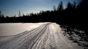
Night skiing the Pembina Nordic Trails
Since November I have taken advantage of the moonlit nights by dusting off the nordic skis and hitting the Pembina Nordic Ski Trails.
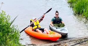
Lakes and rivers offer recreation and relaxation
“Paddling Drayton Valley and Brazeau County lakes and rivers truly is a blessing! It’s such a beautiful area you can paddle the Brazeau Dam and see so many birds and nesting grounds,” said Titanich.

Keystone Heritage Trail
Subscribe for the full Free Press Share on facebook Facebook Share on email Email Share

Homesteaders Way: Hwy 13 Winfield to Alder Flats
Subscribe for the full Free Press The homesteaders way: Hwy 13 Winfield to Alder Flats
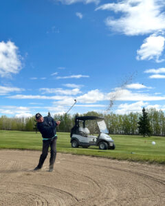
Golfing Drayton Valley
But there was lots to like. The course itself is in very good shape, in spite of our efforts to dig parts of it up with an over enthusiastic pitching wedge. And it was great to get out in some early morning sunshine.

